Is this okay?
You are better off using a shorter time frame than that so that you get a more accurate reading . But it is good to use a longer time frame to get an idea what the level was when it was good for you .
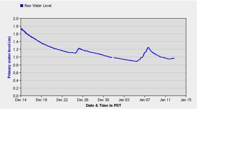
I use the Veddar Crossing chart myself , that looks like the Slesse Creek chart you have there . Either is good but I just use one so that I'm familiar with levels all the time rather than trying to use two different readings .
Veddar crossing is approximately 2.25 meters right now which can be okay but that depends on whether the river is rising or falling . If it's rising than chances are it's brown water , if it has risen significantly already at that point. But if it is at 2.25 and has fallen from , say , 2.45 meters like it was a week earlier , than it is probably clear water. At 2.45 meters most of the river between the crossing and the train bridge have water ripping pretty good through all the runs . At 3 meters the river is bank to bank , whereas at 1.8 meters the river is getting low and the canal is cross-able in many locations with lots of islands showing .
Any way , at this point it is at 2.25 and rising from 2.15 a few days ago , which doesn't bode well , should it rise more , probably getting dirty .

 Author
Topic: What is the driving conditions like driving to Chilliwack? (Read 2806 times)

